Historic D.C.
By • May 3, 2017 0 679
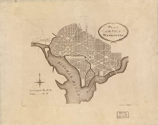
The street grid in the District seems so logical that you’d never guess the mess that ensues every day at rush hour. When Pierre L’Enfant made the city plan in 1790, he laid out the original city in four quadrants radiating from the Capitol, forming the Northwest, Northeast, Southwest and Southeast sections of the city. Then he laid out a north-south grid of numbered streets and an east-west grid of alphabetical streets.
However, over this geometric grid is a complex network of angled avenues, circles, squares and parks meant to enliven the vistas for pedestrians and carriages. L’Enfant wanted to capture the grandeur of European cities; when Thomas Jefferson served as ambassador to France, L’Enfant asked him to bring back the plans for several European cities, including Paris, Milan, Amsterdam and Frankfurt. Their elaborate plans were used to formulate the layout of the District, which makes our city forever beautiful and rush-hour traffic forever challenging.
The north-south streets are numbered sequentially based on their distance from the Capitol. The alphabetical streets run east-west and go from A to W, skipping J. But alphabets, unlike numbers, are finite. So when the sequence, initially of one-syllable words, gets to W, it starts over with a two-syllable word beginning with “A,” as in “Adams” Street. When the two-syllable words corresponding to the alphabet run out, it goes to three-syllable words, such as “Allison” Street.
When the three-syllable words are used up, the naming turns to plant names, so “Aspen” Street follows “Whittier” Street. This is especially prominent in the Northwest quadrant, which was extended far beyond its original northern border of Boundary Street (now Florida Avenue).
There are interesting anomalies, such as the Reed-Cooke section of Adams Morgan, which has some lake names, including Ontario and Champlain. Kalorama Street was once Superior, Euclid was Erie and Fuller was Huron. Columbia Heights had college names for their streets, and still retains Columbia, Harvard and Kenyon.
All the state-named streets are avenues except California Street and Ohio Drive. Pennsylvania Avenue got its prominent place in the city as a consolation prize after Philadelphia lost its bid to be the nation’s capital, and Massachusetts Avenue has the distinction of being the city’s longest street.
MacArthur Boulevard was originally named Conduit Road because it covered an aqueduct carrying water from Great Falls to the District. Foxhall Road was named after Henry Foxall, whose foundry in Georgetown supplied the country with armaments in the War of 1812. It was misspelled on an early road sign and never corrected. Last but not least: Tunlaw Road is “walnut” spelled backwards.
Donna Evers is the owner and broker of the largest woman-owned and woman-run real estate firm in the Washington metropolitan area, the proprietor of Twin Oaks Tavern Winery in Bluemont, Virginia, and a devoted student of D.C.-area history. Reach her at devers@eversco.com.