Corrections and Clarifications on Our Antique Map of Georgetown
By • August 19, 2021 One Comment 1031
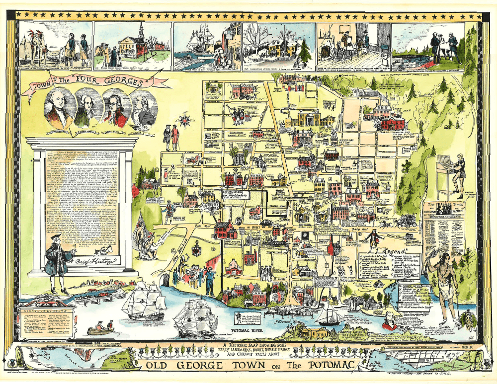
The cover image of the July 14th Georgetowner displayed an antique-style map of Georgetown, drawn by Georgetowner staff artist and designer Carol Stuart Watson in 1959. A reader who lives on Cambridge Place NW wrote us to point out the one-block west misplacement on the map of Cambridge, Dent and Avon Places. Another noted that the map failed to show the location of the Mount Zion Cemetery/Female Union Band Society Cemetery at 27th Street NW and Mill Road, just north of Q Street. In defense of the artist, let us say that she intended the map more as a work of art than of geography. Still, please email your comments or corrections to editorial@Georgetowner.com. Also, send suggestions for a new map which The Georgetowner is planning to publish in anticipation of the semi quincentennial of the United States of America.

In your July 14, 2021 issue you say there is a downloadable copy of this map still available on the website but you do not indicate where on the website it may be found and the image in this article is not framable because the resolution is too low, please help as I’d like one!